


Nov 26, 2025


Nov 19, 2025


In Part 10 of this Waterways We Love series, we spoke of the mighty Mississippi River, its part in completing The Great Loop, about navigation on the Upper Mississippi from Minneapolis/St. Paul south to St. Louis via 29 locks and dams, and the naturally flowing Lower Mississippi from St. Louis south to New Orleans and the Gulf of Mexico.
Within this lower section, several major tributaries feed the Mississippi while being themselves highly navigable for pleasure boats. These tributary rivers are in themselves so long and so navigable that it will take two separate articles to do them justice. Here then is the first part outlining the major tributaries of the Mississippi that drain into it from the east.


The most northerly major tributary of the Mississippi is the relatively short 273 mile (440 km) and shallow Illinois River, which flows southwest across Illinois to join the Mississippi at Grafton, Illinois, about 25 miles (40 km) north of St. Louis, Missouri. There are eight locks and dams operated by the United States Army Corps of Engineers (USACE). The river officially starts where the Kankakee and Des Plaines Rivers join together roughly 10 miles (16 km) southwest of Joliet, IL.
We touched on boating on the Illinois River in Part 9, so we don’t need to expound here on how valuable this river is to pleasure boating by connecting the Mississippi River to the Great Lakes. The Illinois River is part of the Illinois Waterway system from the mouths of the Chicago or the Calumet Rivers on Lake Michigan through to the Mississippi River, a distance of some 335 miles (540 km).

We briefly touched on the Ohio River in Part 2 - History of the Tennessee Valley Authority (TVA) and Part 8 - The Tennessee-Tombigbee Waterway. In both, we talked of the Ohio River tributary and the Tennessee River providing access to an alternative route to and from the Gulf of Mexico.
The Ohio River begins where the Allegheny and Monongahela Rivers join together in Pittsburgh, Pennsylvania. From Pittsburgh it flows some 980 fully navigable miles (1,575 km) southwest to Cairo, Illinois, some 190 miles (310 km) south of St. Louis where it empties into the Mississippi River. It is the largest tributary by volume of the Mississippi and is even larger than the Mississippi where the two join. It borders or flows through six states and is the drainage basin for 14 states.

But, if you are boating up the Ohio River, you can keep going when you reach Pittsburgh. You have already encountered some 20 locks and dams headed upstream the 980 miles from the Mississippi to Pittsburgh and you can boat an additional 72 miles (116 km) upstream on the Allegheny River through more locks and dams as far as East Brady, PA. You may in addition take the other fork for 130 miles (210 km) due south up the Monongahela, locally referred to as the Mon River via its nine locks and dams into north-central West Virginia.
Your trip up the Ohio River from Cairo, IL to Pittsburgh, PA will have taken you through such notable cities as Evansville, IN, Louisville, KY, Cincinnati, OH, and Wheeling, WV, among many others. The USACE maintains the locks and dams as well as the nine-foot deep navigation channel along the entire length of the otherwise fairly shallow river. If you are doing the Great Loop, you may be tempted to only experience the bottom roughly 50 miles (80 km) of the Ohio River to or from where the Tennessee River joins it. If so, you would miss out on virtually all of the above including some of the most notable historic sites in all of the United States.
For example, in the years before the Civil War, the Ohio River was considered an extension of the Mason-Dixon Line, the border between Pennsylvania and Maryland, as the border between the free states of the north and the slave states of the south. It was often referred to as the River Jordan by slaves crossing it to escape to freedom in the north via the Underground Railway. The expression “sold down the river” originated with slaves who were shipped via the river to cotton and sugar plantations further south. Forts on the river from the period include Forts Pitt and McIntosh in Pennsylvania, Randolph and Henry in West Virginia, Harmar and Washington in Ohio, and Fort Nelson in Kentucky.
The route of the Ohio River delineates a climate transition area between the humid continental and humid subtropical climate regions. Superb agricultural production within its watershed required ever-expanded markets for its goods. That would be greatly enhanced through the Port of New Orleans and was a major factor in the United States’ purchase of Louisiana in 1803.
By 1929, USACE had completed the channelization of the river which turned it into a series of reservoirs along its length and thus eliminating shallow areas and promoting commercial barge traffic. The river now is heavily industrialized and populated but also very ideal for pleasure boating which is enthusiastically catered to throughout its entire length.

This river is not a tributary of the Mississippi River but a distributary, meaning that water from the Mississippi River drains into the Atchafalaya within the Mississippi Delta some 50 miles (80 km) north of Baton Rouge. It is only some 137 miles (220 km) long and flows south away from the route of the Mississippi through the Delta.
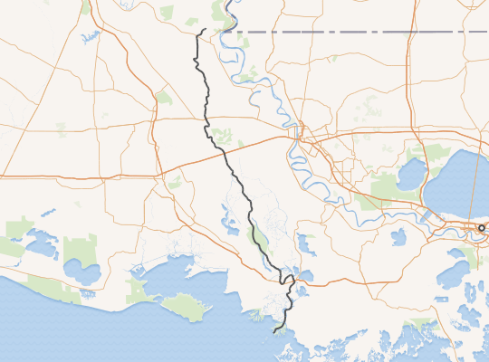
It has one lock and a channel maintained at 12 feet (3.7 m) deep by 125 feet (38 m) wide. It is mentioned here only as an aside, but as a most welcome aside, especially for pleasure boaters for the fact that it shortens the distance to and from the Mississippi and the western branch of the Intracoastal Waterway by 160 miles (260 km). It also skirts around the busy commercial ocean-going deep-draft river section between New Orleans and Baton Rouge. Also, as we shall discover in the next section, it is the confluence from the west of the Red River of the South. You might also like:


Comments