


Nov 26, 2025


Nov 19, 2025


Modern electronics have made boating easier than ever, but they’ve also created a quiet dependency. When screens fail, signals drop, or charts are outdated, the ability to read the water itself becomes invaluable. We can't always rely on technology to save us.
And once you know what to look for, the clues are everywhere.
Start with color. In clear water, darker areas usually indicate depth, while lighter patches suggest a shallower bottom or sandbars. But this isn’t universal: algae, rocks, and lighting conditions can flip that assumption. The key is consistency. Watch how colors change relative to known depths, and patterns will start to emerge.
Next, look at wave patterns. Smooth water surrounded by ripples can signal a shallow area where waves are being disrupted. Conversely, choppy, irregular water in an otherwise calm area may indicate submerged rocks or current interaction.
Speaking of current — moving water tells a story. In rivers or narrow channels, you can often see faster water as darker, smoother “lanes.” Eddies, swirls, and seams between currents can indicate depth changes or underwater obstructions.

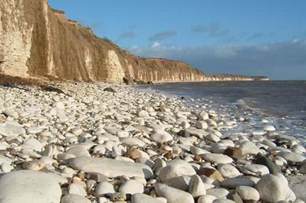
Shorelines offer clues, too. Gradual sandy beaches typically mean a gentle slope leading to deeper water. Rocky shorelines often continue below the surface and a gradual transition increasing in depth cannot be assumed. Points of land frequently extend farther out than expected. One of the most common places boaters run aground is where points of land extend outward into the body of water: what was assumed to have slipped below the surface is still there.
Vegetation is another giveaway. Reeds, lily pads, and weed beds almost always indicate shallow water. If you see them ahead, you’re already too close for comfort. Look for areas where vegetation collects. The larger the collection, the larger the area around this collection is likely to contain shallow water. Give space accordingly.

Even other boats can help you read conditions. Watch where experienced operators travel — and where they don’t. If you're on a busy waterway where seasoned boaters typically travel, their paths often trace safe water more accurately than a chart. That's not to say follow them blindly, but to look to them for guidance.
If you're on a waterway you visit often, scan the water for the patterns listed above and reference them against your charts. That way if your electronics ever fail, you'll have developed a solid mental map of your local waterway. This will give you a useable database in your memory of the observable depths, surface hazards, and water currents based on your cross-referencing against your electronics.
None of this replaces electronics, but it does complement them. The best boaters don’t rely on just one source of information. They cross-reference what they see on a screen with what they see on the water. There is something to be said for tradition, and for understanding the fundamentals. Sailors have been using the same methods for navigation for literally centuries. There may come a time where your electronics fail. What will you do then?
The water is always telling you something. You just have to know how to read it.


I once approched a log "floating" down the river. As I neared it I noticed the current was leaving a wake behind it. It turned out that it was anchored to the bottom and wasn't really floating at all. The lesson learned is to always treat anything on the surface, as merely the tip of an iceberg.